
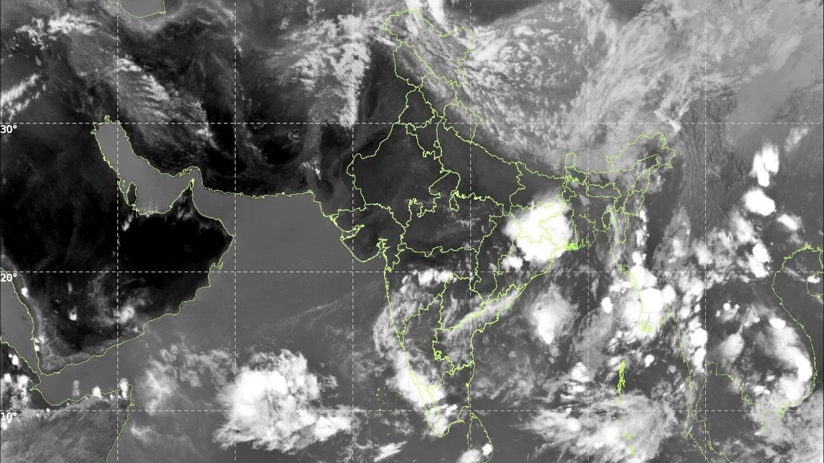
Wednesday was another story of two weather systems moving in opposite directions.
The south witnessed considerable activity, with most stations in Andaman and Nicobar Islands getting drenched, while Telangana, Rayalaseema, coastal parts of Andhra Pradesh, Karnataka and Lakshadweep received significant rainfall.
Bhootpur in Mahabubnagar district of Telangana recorded the day’s highest rainfall of 11 cm. Heavy rain was also witnessed in parts of Andhra Pradesh, Telangana, Rayalaseema, Tamil Nadu and Karnataka and hailstorm occurred at isolated places in Marathwada and Uttarakhand.
In North and across Central India, the story was very different.
Heat wave to severe heat wave conditions are continuing in Eastern Uttar Pradesh, as well as in Haryana, Western Uttar Pradesh, Western and Eastern Madhya Pradesh, Vidarbha and Chhattisgarh.
In view of the rising heat, Prime Minister Narendra Modi issued an advisory, urging citizens to prioritize safety as temperatures rise. He stressed on staying hydrated, carrying water bottles and giving water to the needy.
PM Modi advised people to keep an eye out for symptoms of heat exhaustion such as dizziness and fatigue, and also encouraged people to regularly check on elderly family members. He also appealed for compassion towards wildlife and asked citizens to keep water bowls for birds and animals.
there will be a storm today
Thursday is going to be a changing day for North India. Today is the day for which North and Central India was waiting.
A fresh Western Disturbance arrives from May 28, and it is becoming severe.
As a result, the forecast for Punjab, Haryana, Chandigarh and Delhi and western Uttar Pradesh includes a squall with wind speed of 60-70 kmph gusting to 80 kmph.
Eastern Uttar Pradesh also faces a similarly dangerous storm, while isolated hailstorm is expected in Uttar Pradesh, Gangetic West Bengal, Haryana, Delhi, Himachal Pradesh, Punjab and Uttarakhand.
There is a possibility of strong storm with speed of 50-60 km per hour in Andhra Pradesh, East Uttar Pradesh, Jammu and Kashmir, Jharkhand, Odisha, Rajasthan and Uttarakhand.
Additionally, dust storm is expected over Rajasthan and Uttar Pradesh, and heavy rainfall is expected at isolated places over Assam and Meghalaya, Bihar, Nagaland, Manipur, Mizoram and Tripura, and Tamil Nadu and Puducherry.
Despite all this storm activity, heat wave conditions will still prevail over many areas including Chhattisgarh, East Rajasthan, Haryana, Delhi, Himachal Pradesh, Goa, Odisha, Punjab, Telangana, Uttar Pradesh and West Madhya Pradesh. Severe heat wave is likely over East Madhya Pradesh, Vidarbha and West Rajasthan.
Monsoon delayed but not by much
There is actually good news on the horizon, too.
India’s life-giving seasonal rainfall system, called the southwest monsoon, advanced on Wednesday and extended over the remaining parts of the southwest and southeast Arabian Sea, Lakshadweep, the Bay of Bengal and the Andaman Sea.
Conditions are expected to remain favorable for its further northward movement in the next two to three days.
More immediately, temperatures in northwest India are forecast to drop by 6-8 degrees Celsius between May 28 and May 30, which will mark a much-needed drop after weeks of scorching heat.
For millions of people who cook in Uttar Pradesh, Delhi, Punjab and Haryana, the worst may be almost over. Monsoon has arrived late, but as the saying goes, better late than never.
– ends